


Winterwanderweg: Glashüttenweg


- Flatly
- Possible accommodation
Interactive elevation profile
Create PDF
Tour-Details
Path number: 63
Starting place: 4164 Schwarzenberg am Böhmerwald
Destination: 4164 Schwarzenberg am Böhmerwald
duration: 1h 42m
length: 5,4 km
Altitude difference (uphill): 189m
Altitude difference (downhill): 190m
Lowest point: 783m
Highest point: 949m
difficulty: medium
condition: easy
panoramic view: Some Views
Paths covering:
snow
powered by TOURDATA
information: Akutmeldung/Information
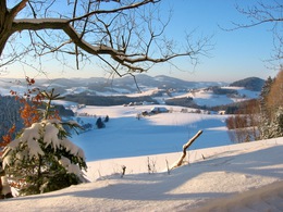
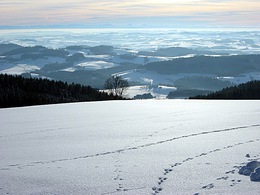
A rolled cross-border winter hiking trail in the Bohemian Forest vacation area.
From Gasthof Dreiländereck, the winter hiking trail leads along the Oberschwarzenberg goods road to the car park, where it turns left and crosses the border with Germany at the Grenzbach stream. It leads downhill through the forest to the scattered settlement of Lackenhäuser, past the Rosenberger Gut, then turns left to the entrance to the camping park. Behind the park, the path leads into the forest. Cross the "Grablbrücke" bridge (border) and return via the "Zinngießer Hof" farm. Then continue downhill to Oberschwarzenberg to the starting point.
With the free outdooractive app, you can hike the trail using navigation.
further information:
- Flatly
- Possible accommodation
- Board possible
Details - hiking
- cleared winter hiking path
Parking
- Parking space: 15
Most economical season
- Early winter
- Deep winter
Please get in touch for more information.
Hauptstraße 4
4164 Schwarzenberg am Böhmerwald
Phone +43 5 7890 - 100
Fax machine +43 5 7890 - 115
E-Mail info@boehmerwald.at
Web www.boehmerwald.at
https://www.boehmerwald.at
You can also visit us on
Visit us on Facebook Visit us on Instagram Visit our videochannel on YouTube")
Interactive elevation profile
Create PDF
Tour-Details
Path number: 63
Starting place: 4164 Schwarzenberg am Böhmerwald
Destination: 4164 Schwarzenberg am Böhmerwald
duration: 1h 42m
length: 5,4 km
Altitude difference (uphill): 189m
Altitude difference (downhill): 190m
Lowest point: 783m
Highest point: 949m
difficulty: medium
condition: easy
panoramic view: Some Views
Paths covering:
snow
powered by TOURDATA