


Rennradtour Dreiländer Bayern-Tschechien-Österreich


- Flatly
- Possible accommodation
Interactive elevation profile
Create PDF
Tour-Details
Starting place: 4160 Aigen-Schlägl
Destination: 4160 Aigen-Schlägl
duration: 8h 0m
length: 157,0 km
Altitude difference (uphill): 2.190m
Altitude difference (downhill): 2.193m
Lowest point: 583m
Highest point: 1.193m
difficulty: difficult
condition: difficult
panoramic view: Great panorama
Paths covering:
Asphalt
powered by TOURDATA
Through the Bavarian Forest up to the watershed and via the Vltava Valley in the Czech Republic back to Austria
0 km This tour starts in Aigen-Schlägl. Leave the market square in a north-westerly direction. Turn right onto the Dreisesselberg country road, which will take you to
6 km Ulrichsberg. Continue through Salnau and Klaffer am Hochficht, from here you will reach
15 km Schwarzenberg. After approx. 1 km you will cross the border into Bavaria. The route takes you downhill to Klafferstraß, turn right after approx. 3 km, turn right again in Langbruck and follow the route uphill to
25 km Neureichenau and on to Altreichenau In the town centre, turn left onto Hochstraße. Continue to Vorderfreundorf, where you turn right towards Grainet. From Grainet, follow Graineter Straße for approx. 4 km and turn right towards Kaining. The tour continues to Hinterschmiding and
45 km Sonnendorf. From here it is uphill to Heldengut, turn left, continue through Annathal, Mauth, Heinrichsbrunn and
63 km Finsterau. The tour continues uphill, crossing the border to the Czech Republic and thus also the European watershed. From here it is downhill again to
74 km Kvilda. In the village turn right towards Borova Lada (Ferchenhaid) and continue on the main road through the Sumava National Park to
94 km Horni Vltavice (Obermoldau) . The tour now continues uphill to Lenora (Eleonorenhain), approx. 3 km after the village turn right to Soumarsky Most, cross the Vltava and follow the road downhill to Cesky Zleby (Bohemian Tubes) and on to
113 km Stozec (Tusset). Keep left along the railway tracks, which you will also cross several times. Continue along the Vltava valley to
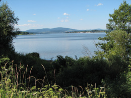
130 km Nova Pec (Neuofen) on the Vltava reservoir. The tour takes you to Blizsi Lhota (Vorderstift) and Zadni Zvonkova (Glöckelberg). Cross the border to Austria and after a short climb you will reach Schöneben
146 km. A steep descent takes you to Ulrichsberg, the Dreisesselberg country road brings you back to your starting point
157 km Aigen-Schlägl.
You can navigate the route using the free outdooractive app.
0 km This tour starts in Aigen-Schlägl. Leave the market square in a north-westerly direction. Turn right onto the Dreisesselberg country road, which will take you to
6 km Ulrichsberg. Continue through Salnau and Klaffer am Hochficht, from here you will reach
15 km Schwarzenberg. After approx. 1 km you will cross the border into Bavaria. The route takes you downhill to Klafferstraß, turn right after approx. 3 km, turn right again in Langbruck and follow the route uphill to
25 km Neureichenau and on to Altreichenau In the town centre, turn left onto Hochstraße. Continue to Vorderfreundorf, where you turn right towards Grainet. From Grainet, follow Graineter Straße for approx. 4 km and turn right towards Kaining. The tour continues to Hinterschmiding and
45 km Sonnendorf. From here it is uphill to Heldengut, turn left, continue through Annathal, Mauth, Heinrichsbrunn and
63 km Finsterau. The tour continues uphill, crossing the border to the Czech Republic and thus also the European watershed. From here it is downhill again to
74 km Kvilda. In the village turn right towards Borova Lada (Ferchenhaid) and continue on the main road through the Sumava National Park to
94 km Horni Vltavice (Obermoldau) . The tour now continues uphill to Lenora (Eleonorenhain), approx. 3 km after the village turn right to Soumarsky Most, cross the Vltava and follow the road downhill to Cesky Zleby (Bohemian Tubes) and on to
113 km Stozec (Tusset). Keep left along the railway tracks, which you will also cross several times. Continue along the Vltava valley to
130 km Nova Pec (Neuofen) on the Vltava reservoir. The tour takes you to Blizsi Lhota (Vorderstift) and Zadni Zvonkova (Glöckelberg). Cross the border to Austria and after a short climb you will reach Schöneben
146 km. A steep descent takes you to Ulrichsberg, the Dreisesselberg country road brings you back to your starting point
157 km Aigen-Schlägl.
You can navigate the route using the free outdooractive app.
Most economical season
- Spring
- Summer
- Autumn
Please get in touch for more information.
Hauptstraße 2
4160 Aigen-Schlägl
Phone +43 5 7890 - 100
Fax machine +43 5 7890 - 115
E-Mail info@boehmerwald.at
Web www.boehmerwald.at
Web www.almesberger.at
https://www.boehmerwald.at
https://www.almesberger.at
https://www.almesberger.at
You can also visit us on
Visit us on Facebook Visit us on Instagram Visit our videochannel on YouTube")
")
Interactive elevation profile
Create PDF
Tour-Details
Starting place: 4160 Aigen-Schlägl
Destination: 4160 Aigen-Schlägl
duration: 8h 0m
length: 157,0 km
Altitude difference (uphill): 2.190m
Altitude difference (downhill): 2.193m
Lowest point: 583m
Highest point: 1.193m
difficulty: difficult
condition: difficult
panoramic view: Great panorama
Paths covering:
Asphalt
powered by TOURDATA