


Rennradtour rund um den Moldaustausee


- Flatly
- Possible accommodation
Interactive elevation profile
Create PDF
Tour-Details
Starting place: 4160 Aigen-Schlägl
Destination: 4160 Aigen-Schlägl
duration: 5h 30m
length: 96,0 km
Altitude difference (uphill): 1.234m
Altitude difference (downhill): 1.237m
Lowest point: 583m
Highest point: 946m
difficulty: medium
condition: medium
panoramic view: Dreamtour
Paths covering:
Asphalt
powered by TOURDATA
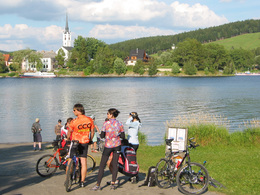
A medium-difficulty road bike tour around the Lipno (Vltava reservoir) in the Czech Republic.
0 km This tour starts in Aigen-Schlägl. Leave the market square in a north-westerly
direction, then immediately turn right onto Höhenstraße, which takes you uphill to
5 km Grünwald. As soon as you reach the level at the end of the forest,
turn right and the road takes you to Oberhaag. Turn left downhill and pass the Austrian/Czech border. Approx. 1.5 km after the border, turn right at the large crossroads. Now your route runs almost flat along the Vltava reservoir to
21 km Frydava (Friedau). Follow the road further along the lake to the dam.
Cross the bridge to the left and you will reach
32 km Lipno nad Vltavou (Lippen). The road runs along the lake to Frymburk
(Friedberg). Through the villages of Milna and Planicka you reach
50 km Cerna v Posumavi (Schwarzbach). Your tour continues over the bridge through
Hurka and Karlovy to
57 km Horni Plana (Upper Plan). Continue along the main road through Pernek to Zelnava. Turn left here and continue along the main road until you reach
68 km Nova Pec (Neuofen). Turn left and cross the railway tracks. Your
tour continues through the Sumava National Park to
76 km Blizsi Lhota (Vorderstift). border crossing Czech Republic/Austria and then to
85 km Schöneben. Downhill you reach Ulrichsberg, at the roundabout take
the exit to the left. The Dreisesselberg country road takes you back to your starting point
96 km Aigen-Schlägl.
Use the free outdooractive app to navigate the route.
Most economical season
- Spring
- Summer
- Autumn
Please get in touch for more information.
Hauptstraße 2
4160 Aigen-Schlägl
Phone +43 5 7890 - 100
Fax machine +43 5 7890 - 115
E-Mail info@boehmerwald.at
Web www.boehmerwald.at
Web www.almesberger.at
https://www.boehmerwald.at
https://www.almesberger.at
https://www.almesberger.at
You can also visit us on
Visit us on Facebook Visit us on Instagram Visit our videochannel on YouTube")
")
Interactive elevation profile
Create PDF
Tour-Details
Starting place: 4160 Aigen-Schlägl
Destination: 4160 Aigen-Schlägl
duration: 5h 30m
length: 96,0 km
Altitude difference (uphill): 1.234m
Altitude difference (downhill): 1.237m
Lowest point: 583m
Highest point: 946m
difficulty: medium
condition: medium
panoramic view: Dreamtour
Paths covering:
Asphalt
powered by TOURDATA