


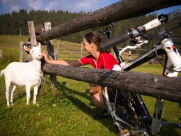
Mountainbikestrecke: Grenzlandrunde


Interactive elevation profile
Create PDF
Tour-Details
Path number: 3
Starting place: 4162 Julbach
Destination: 4162 Julbach
duration: 6h 1m
length: 64,6 km
Altitude difference (uphill): 1.983m
Altitude difference (downhill): 1.980m
Lowest point: 494m
Highest point: 939m
difficulty: medium
condition: medium
panoramic view: Great panorama
Paths covering:
Asphalt, Path / trail
powered by TOURDATA
Steep climbs and fantastic descents are characteristic of this tour.
The route starts right on the German border at Gasthof Greiner - in Kohlstatt. From there it goes to Julbach, also known as the "Meran of the Mühlviertel", and to Peilstein, where you cycle over the Kühstein to the village of Rutzersdorf. You then cycle uphill and downhill on beautiful natural paths to Sarleinsbach. Pass the "Sarleinsbacher Naturbad" swimming pool and cycle up to the Ameisberg, whose viewing platform (940 m) is the highest point between the Danube and the Bohemian Forest and offers a panoramic view of the region. Continue to Kollerschlag through the new, generously designed market square and cycle back to Kohlstatt.
The route starts right on the German border at Gasthof Greiner - in Kohlstatt. From there it goes to Julbach, also known as the "Meran of the Mühlviertel", and to Peilstein, where you cycle over the Kühstein to the village of Rutzersdorf. You then cycle uphill and downhill on beautiful natural paths to Sarleinsbach. Pass the "Sarleinsbacher Naturbad" swimming pool and cycle up to the Ameisberg, whose viewing platform (940 m) is the highest point between the Danube and the Bohemian Forest and offers a panoramic view of the region. Continue to Kollerschlag through the new, generously designed market square and cycle back to Kohlstatt.
Most economical season
- Spring
- Summer
- Autumn
Please get in touch for more information.
Schulstraße 4
4162 Julbach
Phone +43 5 7890 - 100
Fax machine +43 5 7890 - 115
E-Mail info@boehmerwald.at
Web www.boehmerwald.at
https://www.boehmerwald.at
You can also visit us on
Visit us on Facebook Visit us on Instagram Visit our videochannel on YouTube")
")
")
")
Interactive elevation profile
Create PDF
Tour-Details
Path number: 3
Starting place: 4162 Julbach
Destination: 4162 Julbach
duration: 6h 1m
length: 64,6 km
Altitude difference (uphill): 1.983m
Altitude difference (downhill): 1.980m
Lowest point: 494m
Highest point: 939m
difficulty: medium
condition: medium
panoramic view: Great panorama
Paths covering:
Asphalt, Path / trail
powered by TOURDATA